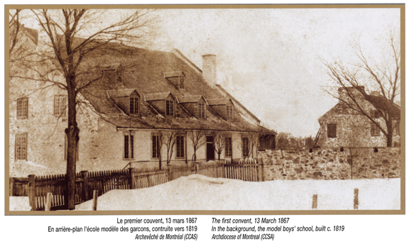
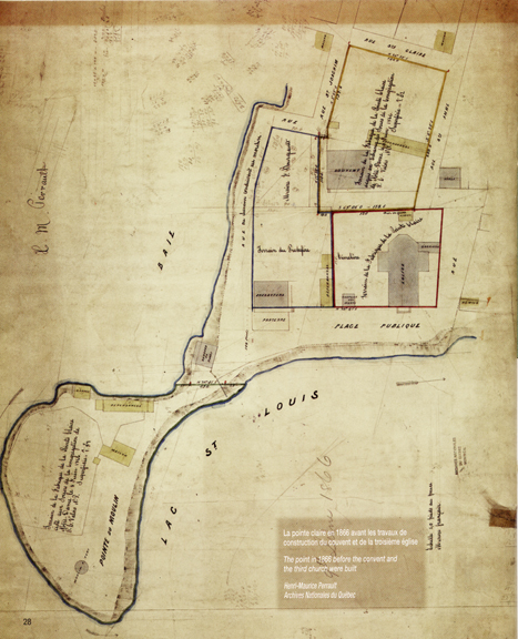
La carte de droite démontre la location de la deuxième église. La rue Ste-Anne arrêtait juste au nord de celle-ci. Elle continue maintenant jusqu’au bord de l’eau. L’église actuelle est située à gauche de l’ancienne (là où le cimetière s’est déjà trouvé). Le premier couvent utilisé par la congrégation de Notre-Dame était situé au nord ouest de l’église. Un nouveau et plus grand couvent a été construit en 1867 sur la pointe à côté du moulin.
The map on the right shows the location of the second church. St Anne Street which stopped north of it now goes straight through to the waterfront. The present day church is to the left of the old one (where the cemetery once stood). The first convent used by the Congregation of Notre Dame was northwest of the church. A new larger convent was built in 1867 on the point beside the windmill.